
Applications and Map Viewers
The Map Viewers, developed using the ESRI ArcGIS for Server technology, allow users to display, find, identify, and print map features located in Montgomery County, Maryland. The Montgomery County Government believes that the data presented in these Map Services are accurate. However, the Montgomery County Government and its data suppliers do not guarantee and make no warranties for the accuracy of the data presented in these map viewers. Please read the Internet Map Server Disclaimer carefully prior to selecting an Internet Map Service, or a map viewer .

Montgomery County Property Map Viewer (Accessible Map)
This Map Viewer displays many property related data (Zoning, Contour, Water Category, Sewer, and Aerial Image) in a map format. It also provides charting, query, zoom in/out, and print map functionalities.
This Map Viewer displays many property related data (Zoning, Contour, Water Category, Sewer, and Aerial Image) in a map format. It also provides charting, query, zoom in/out, and print map functionalities.

Official Zoning of Montgomery County, Md. (Query and Print)
The official zoning maps are maintained in GIS format by the Planning Department (MNCPPC). Each proposed change will appear in this data and through this web application after it is approved by the Montgomery County Council.
The official zoning maps are maintained in GIS format by the Planning Department (MNCPPC). Each proposed change will appear in this data and through this web application after it is approved by the Montgomery County Council.
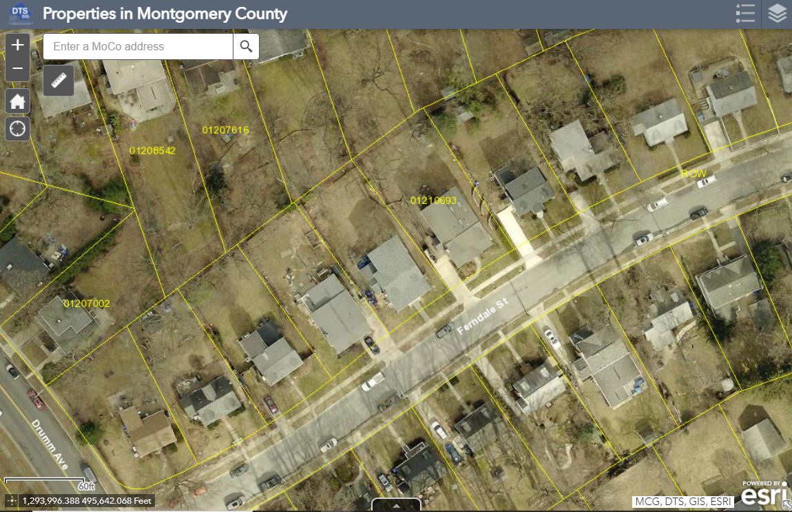
Properties in Montgomery County
This useful map application allows users to zoom in to a property and a popup window will display information about the property.
This useful map application allows users to zoom in to a property and a popup window will display information about the property.
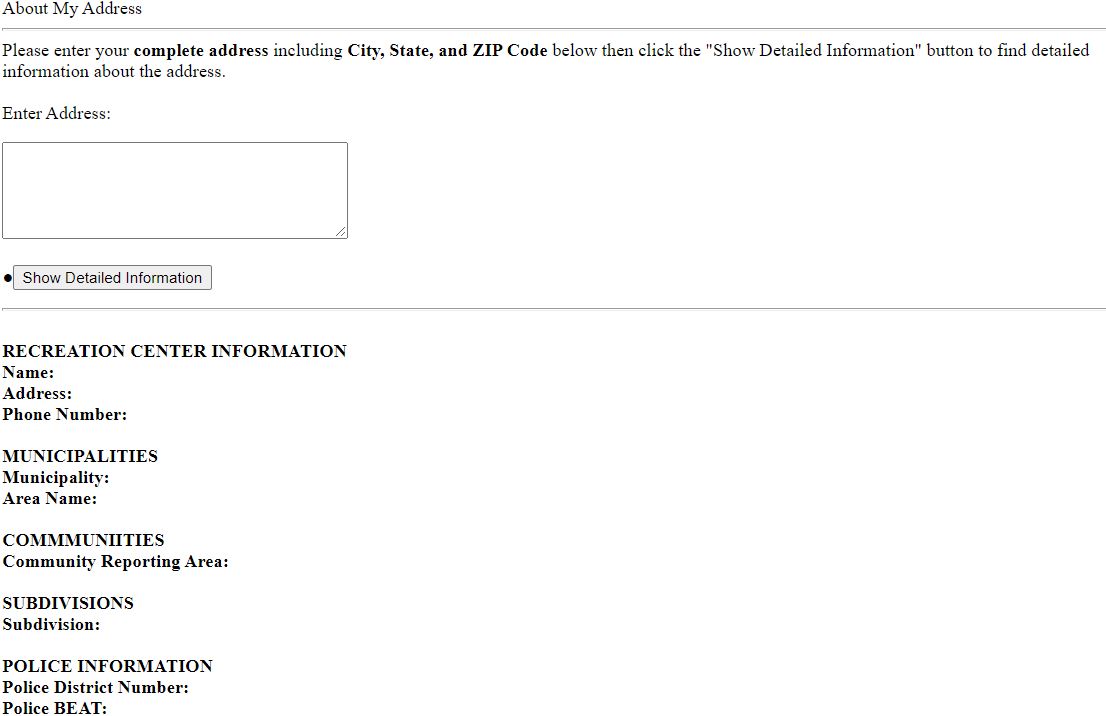
About My Address
A useful text-based application that prompts users to enter an address then it will provide all the useful infomration such as: Regional Service Centers, Municipalities, Communities, Subdivisions, Police Geography, Fire Geography, Council Distirct, State Legislature, Congressional District, Solid Waste, Planning Areas, Water Sheds, and Census Block Group Data.
A useful text-based application that prompts users to enter an address then it will provide all the useful infomration such as: Regional Service Centers, Municipalities, Communities, Subdivisions, Police Geography, Fire Geography, Council Distirct, State Legislature, Congressional District, Solid Waste, Planning Areas, Water Sheds, and Census Block Group Data.
Montgomery County Bikeways Map Viewer (Accessible Map)
Use this map to find a Montgomery County Bikeway route, path, or trail.
Use this map to find a Montgomery County Bikeway route, path, or trail.
Demographic Data Viewer (Accessible Map)
View race data in pie chart and age data in bar graph, for Census Tracts and Block Groups. Data source: 2012 American Community Survey, US Census Bureau.
View race data in pie chart and age data in bar graph, for Census Tracts and Block Groups. Data source: 2012 American Community Survey, US Census Bureau.
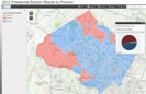
2012 and 2016 Presidential Election Results by Precinct Map Viewer (Accessible Map)
Click on an area of the County to view individual precincts' results from the 2012 and the 2016 Presidential Election. Use the Slider to compare 2012 and 2016 Presidential Election Results. Data source: Maryland Board of Elections.
Click on an area of the County to view individual precincts' results from the 2012 and the 2016 Presidential Election. Use the Slider to compare 2012 and 2016 Presidential Election Results. Data source: Maryland Board of Elections.

Montgomery County Public Safety Map Viewer (Accessible Map)
Fire stations are presented with roads and municipal boundary data. In addition, Police districts, beats, and reporting areas are also provided.
Fire stations are presented with roads and municipal boundary data. In addition, Police districts, beats, and reporting areas are also provided.
Montgomery County Streetlight Web Map
Report a Streetlight malfunction using this map service. Developed by TEBS-ADT.
Report a Streetlight malfunction using this map service. Developed by TEBS-ADT.

Historical Image Map Viewer
Digital aerial photos and orthophotos taken in various years are currently served using Lizardtech's MrSID Image Server technology. The photos are indexed by the WSSC map tile.
Digital aerial photos and orthophotos taken in various years are currently served using Lizardtech's MrSID Image Server technology. The photos are indexed by the WSSC map tile.