
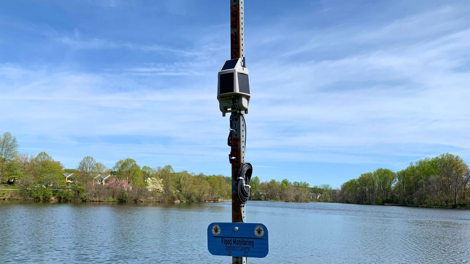
Flood Sensors
What is the Flood Sensor Partnership?
Through the Flood Sensor Partnership, the federal Department of Homeland Security (DHS) has provided 40 sensors to Montgomery County. The has installed these sensors in numerous flood-prone areas to detect rising water levels and alert County personnel of emerging issues. These alerts, warnings, and flood notifications help communities stay prepared and protects important infrastructure.
Background
The Flood Sensors deployed in the County through this project have been developed by the DHS Science and Technology Directorate with scientists, equipment manufacturers, and stormwater management programs around the US to develop scalable, low-cost flood-sensor networks in response to changing climate conditions that are resulting in more frequent and higher intensity storm events. Urban and riverine flooding is a growing issue in Maryland. The increasing number of extreme rainfall events that produce intense precipitation will continue to lead to more urban and riverine flooding events, with increasing demands on public safety programs to mitigate their impacts. The 2017 National Climate Assessment indicates that heavy downpours are increasing nationally, especially over the last three to five decades. The largest increases are in the Midwest and Northeast, including the Mid-Atlantic.
The flood sensors are low-maintenance and DHS is providing all 40 flood sensors at no cost to the County under a Cooperative Research and Development Agreement (CRADA). The County is responsible for installation and maintenance of the sensors, analyzing data accuracy, and piloting local usage such as long-term operations and procedures.
What do the Flood Sensors Do?
The flood sensors automatically detect rising water levels and focus specifically on providing early warnings about high water levels or flooding. They will promote community resilience and prepare communities to respond by providing alerts, warnings, and notifications of flooding, protecting critical infrastructure, and reducing property losses.
Enhancing Storm Event Preparedness and Public Safety
The flood sensors were deployed starting June 2022 at 34 sites identified by DEP and OEMHS, including 14 high or significant hazard dams and 20 low-lying roads and flood- prone areas. These real-time sensors complement and extend the capabilities of the County’s existing operations that include DEPs remote monitoring stations that are part of existing Dam Safety Operations, and OEMHSs tracking and monitoring of water levels at streams and rivers across the County through the existing US Geological Survey (USGS) gauges. Long term real-time water level monitoring at the County’s dam sites will help identify potential clogging and other issues to assist preventive maintenance.
For More Information
- Amy Stevens, Division Chief, Watershed Restoration Division, [email protected]
- Matthias Miziorko, Emergency Management Specialist, Office of Emergency Management and Homeland Security, [email protected]
- Leying Zhang, Senior Engineer, Design & Construction Section, Watershed Restoration Division, [email protected]
Flood Sensors in Montgomery County
Flood sensor locations:
- 2200 Brighton Dam Rd
- 25100 Kings Valley Rd
- 5410 Griffith Rd
- 8755 Block Gue Rd
- Beach Dr & E Stanhope Rd
- Beach Dr & Wyndale Ave
- Burnt Mills at US 29
- Cabin John Creek at Bradley Blvd
- Christie Estates Regional
- Davis Mill Rd & Huntmaster Rd
- Davis Mill Rd & Wildcat Rd
- Environ HOA
- Falls Rd Dam
- Great Seneca Creek at Brink Rd
- Gunners Lake Dam
- Hawlings River at 1898 Brighton Dam Rd
- Hawlings River at 22000 Zion Rd
- Inspiration Lake
- Lake Hallowell
- Lake Nirvana
- Lake Placid
- Lake Whetstone Dam
- Little Seneca Creek at Newcut Rd
- Loghouse Rd at Macgruder Branch
- Olney Oaks
- Pine Lake Dam
- Pueblo
- Rattlewood Dam
- Rock Creek at Knowles Ave
- Rock Creek Woods Apartments
- Sligo Creek Parkway between Park Valley Rd & Houston Ave
- Sligo Creek at New Hampshire Ave
- Sligo Creek at Schuyler Rd
- University Blvd Pond
- Vineyard
- Wheaton Dam
- Downstream of Wheaton Dam
Flood Sensor Map
Type in an address to see flood sensors near you.