
Montgomery County's Flood Model
Montgomery County’s flood model is an integrated 1-D, 2-D model that provides the best current understanding of potential flood risk in the County under certain storm conditions. The results of the model are displayed in the Flood Risk Explorer. As shown in figure and table below, the County currently plans to model eleven watersheds that encompass just over 101,000 acres and are home to nearly two-thirds of the County’s residents.
Flood Model Map
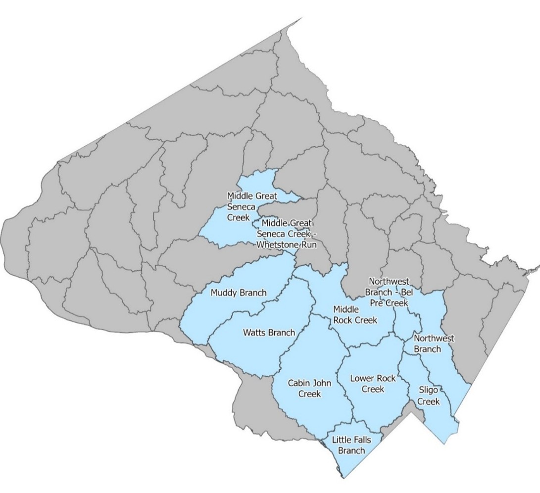
Flood Model Data
| Watershed | Size (Acres) | Scheduled Completion |
|---|---|---|
| Sligo Creek | 6,156 | Completed |
| Lower Rock Creek | 12,005 | March 2026 |
| Middle Rock Creek | 10,780 | March 2026 |
| Cabin John Creek | 16,303 | November 2026 |
| Little Falls Branch | 4,821 | November 2026 |
| Northwest Branch | 9,706 | December 2027 |
| Northwest Branch - Bel Pre Creek | 2,866 | December 2027 |
| Muddy Branch | 12,531 | December 2027 |
| Middle Great Seneca Creek | 9,028 | February 2029 |
| Middle Great Seneca Creek - Whetstone Run | 3,049 | February 2029 |
| Watts Branch | 14,231 | February 2029 |
Scenarios Modeled
As shown in the table below, nine different scenarios are included in the County's flood model – three different storm events at three different points in time. Each of these scenarios reflects a different amount of rainfall, which the model assumes will fall uniformly across the modeled area. This assumption – uniform rainfall across the modeled area – is very unlikely to happen, so the model may understate or overstate the extent and depth of flooding in any particular area during an actual storm event.
Precipitation Depth for Model Scenarios
Inches over 24-Hour Period
| Recurrence Interval | 2020 | 2050 | 2100 |
|---|---|---|---|
| 10-Year | 5.4 inches over 24-hour period | 6.1 inches over 24-hour period | 7.3 inches over 24-hour period |
| 100-Year | 8.4 inches over 24-hour period | 9.7 inches over 24-hour period | 11.9 inches over 24-hour period |
| 500-Year | 10.6 inches over 24-hour period | 12.4 inches over 24-hour period | 15.4 inches over 24-hour period |