Tips On Interactive Map
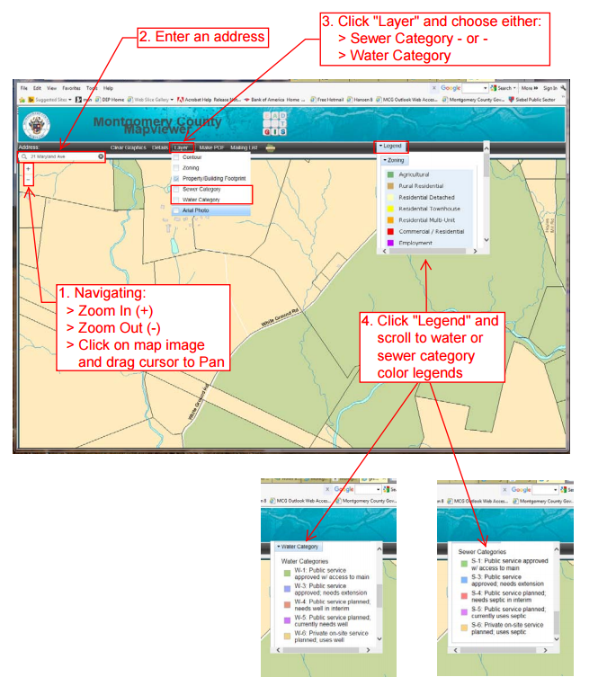
Just as the County's zoning maps are the record of zoning decisions, the water category and sewer category maps show, in a geographic format, the service area categories designated throughout the County. You can find your service area category using the County Map Viewer application—an interactive mapping application.
How to use the interactive map app?
-
To navigate around the map viewer: Use the zoom in (+) and zoom out (-) buttons
-
To locate a property using a street address: enter the address in the box shown and “Enter”. The map image will pan to that location.
-
Click on the “Layer” button and choose either “Sewer Category” or “Water Category” separately.
-
To see the color legends for Water Categories” or “Sewer Categories”, use the scroll bar.

Questions?
For additional information about water and sewer service area categories for specific locations, please contact DEP staff at
[email protected] (preferred) or 240-777-7716.
Question about the County Map Viewer? Contact the
County Department of Technology Services.