Wheaton Branch Flood Mitigation Project
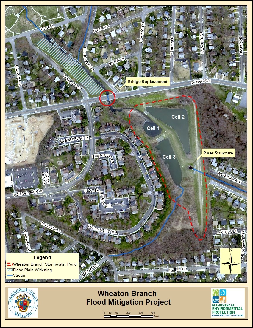
 The Wheaton Branch Regional Stormwater Management Pond, designed and constructed in 1975, drains a 770-acre watershed that is over 50% impervious land cover and provides many benefits downstream in lower Wheaton Branch and Sligo Creek. These benefits include; 1) reduced stream channel erosion as stormwater captured in the pond is slowly released after storms, 2) water quality treatment as sediment and pollutants settle out in the pond, and 3) provides flood control for the downstream area. The pond was retrofitted to its current configuration as a three celled wet pond in 1988 to add water quality treatment. It controls stormwater runoff from a large shopping mall and commercial complex around the Wheaton Metro Station, and other commercial and residential developments between Wheaton and Dennis Avenue along the intensively developed Georgia Avenue corridor.
Issues with flooding were noted in 2006 and 2010 by residents living upstream of Dennis Avenue. A floodplain study commissioned by the Montgomery County Department of Environmental Protection (DEP) revealed that the previously approved Federal Emergency Management Administration (FEMA) map did not reflect the actual floodplain conditions. As a result, FEMA issued a Letter of Map Revision (LOMR) in 2018 that now includes five (5) adjacent residences near the intersection of Glenhaven Road and Dennis Avenue, and several roadways, in the 100-year floodplain. There are an additional eight (8) residential properties impacted by the 100-year floodplain. It was determined that the extensive flooding was caused by water backing up from undersized Dennis Avenue bridge and Wheaton Branch Stormwater Management Pond. To mitigate the flooding the bridge must be replaced in conjunction with floodplain and pond modifications. Montgomery County’s Department of Transportation (DOT) is responsible for the bridge replacement project.
DEP’s flood mitigation project will entail three primary improvements:
- Lower the flood plain on the west side of Wheaton Branch upstream of Dennis Avenue Bridge to provide additional water storage and flood relief.
- Modify the existing Pond riser structure.
- Dredging to remove accumulated sediments from Cell 1 in Wheaton Branch Stormwater Management pond.
Montgomery County’s Department of Transportation and the Department of Environmental Protection are collaborating on these two projects to address the flooding of Dennis Avenue and nearby private properties.
Project Details
| Project Status | In Design |
| Construction Timeline | Winter 2025 - Summer 2026 (nine month duration) |
| Project Cost: | $3.2M |
| Watershed: | Anacostia River |
| Contact: | DEP Engineer: Leying Zhang Leying.Zhang@MontgomeryCountyMD.gov 240-777-7727 |
| Contact: | Doug Marshall Douglas.Marshall@montgomerycountymd.gov (240) 777-7767 |
| Public Meeting: | |
| *Information is subject to change | |
Project Design Plan
DEP’s engineering contractor has prepared site design plans which detail the design and construction of the Wheaton Branch Stream channel upstream of the Dennis Avenue bridge. The site design plan, currently in the final design stage will reduce flooding by providing more water storage capacity. Additional water storage capacity will be accomplished by; 1) widening both the stream channel and the adjacent flood plain and 2) dredging accumulated sediment from the first cell of the Wheaton Branch stormwater management pond. Once the Final design is complete, construction will begin.
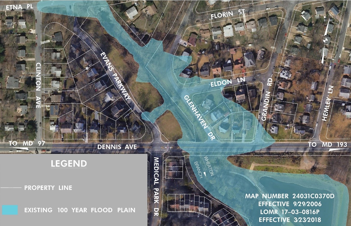
Wheaton Branch Existing 100 Year Flood Plain
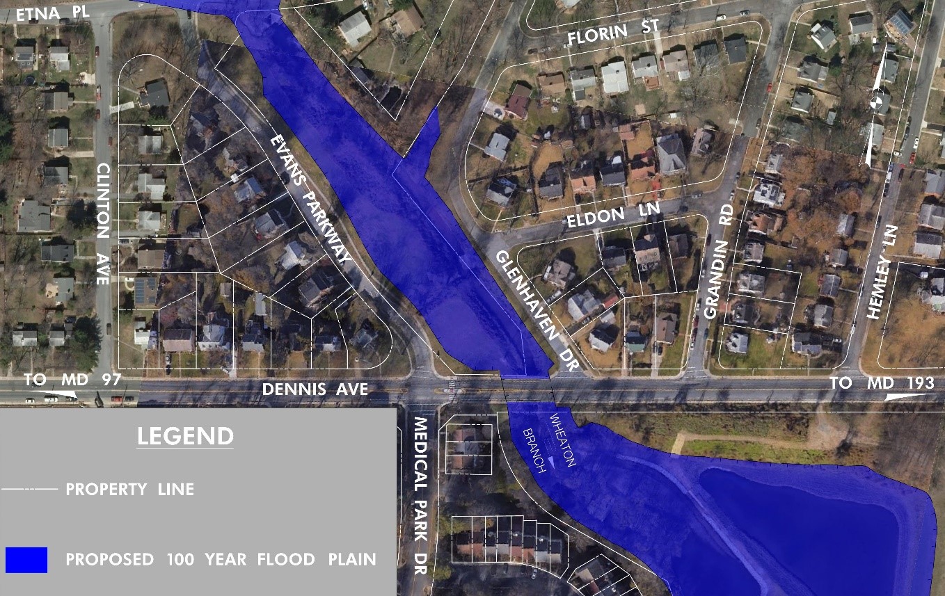
Wheaton Branch Proposed 100 Year Flood Plain