
Bel Pre Road Safety Improvement Project
Improving Safety Along Bel Pre Road
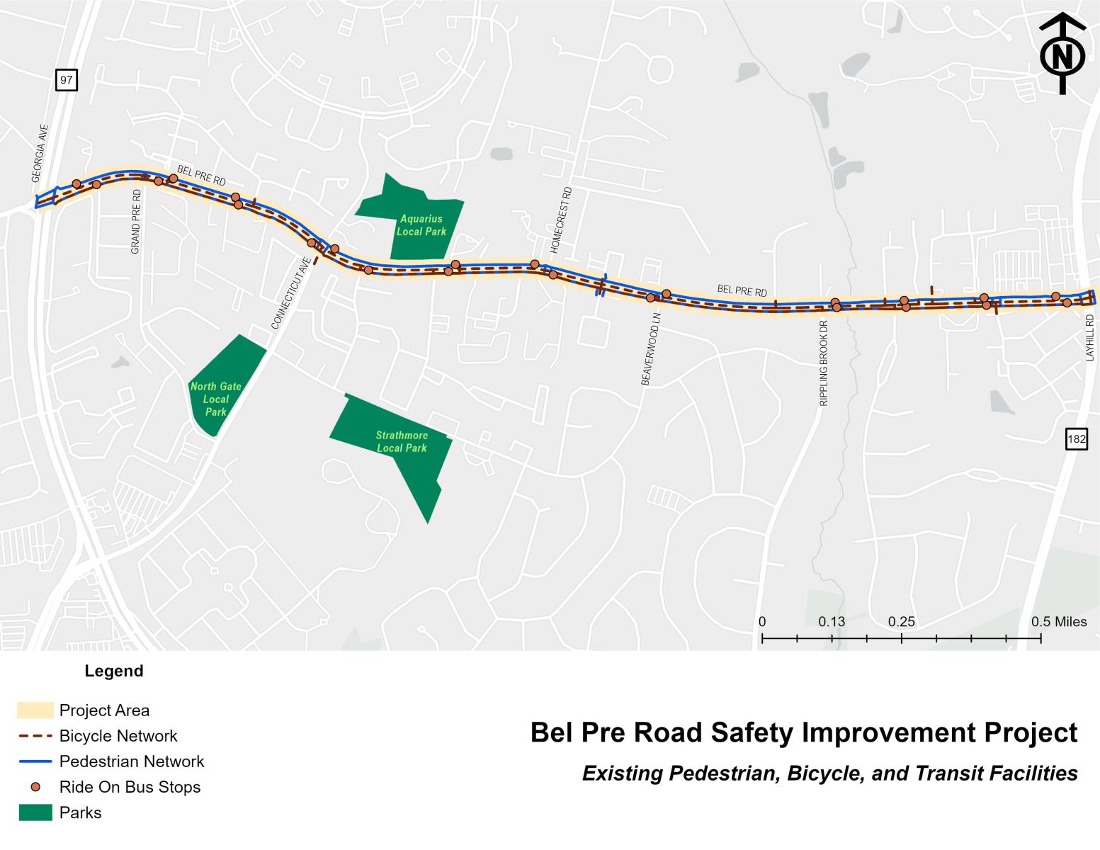
This project will provide safety improvements to help mitigate crashes involving pedestrians and bicyclists along a 1.9-mile stretch of Bel Pre Road between Georgia Avenue and Layhill Road. This segment of roadway is as a Vision Zero High Injury Network with higher number of crashes (at least one crash per mile per year).
After conducting Pedestrian Road Safety Audits and studies of the corridor in 2015 and 2022, we are moving forward with a project design which will include a variety of safety improvements to the corridor. Bel Pre Road serves as a crucial transit corridor with a mix of residential and commercial spaces, but unfortunately, experiences higher-than-average crash rates, specifically those involving pedestrians and bicyclists. The corridor features several bus stops with uncontrolled crossings, lacking traffic control measures like stop signs, yield signs or traffic signals.
MCDOT received public feedback on various options to enhance the existing streetscape and improve roadway safety in the area. Please click the 'Design Work to Date' tab above to learn about the proposed and preferred design option.
The project team has assembled several options for the new typical section of Bel Pre Road. Beginning with three different options for how to lay out the lanes of the roadway, listed below are the design options and community feedback summary:
Bel Pre Road Safety Options – Community Feedback Summary
- Full Road Diet:
Not the community’s preferred option.
This approach would eliminate one travel lane in each direction. - Lane Diet with Curb Adjustments (Preferred Option):
Preferred by the community.- Reduces lane widths to the minimum recommended for this roadway type.
- Shifts the southern curb line to allow for a wider shared-use path on the south side of Bel Pre Road.
- Lane Diet with On-Street Bike Lanes:
Not the community’s preferred option.- Maintains existing curb lines.
- Uses the available space to add protected, on-street bike lanes.
We want to hear from you! MCDOT invites you to take our project survey by clicking this link: Survey
[email protected]
240-777-2190
Area Map